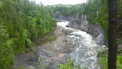
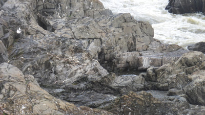
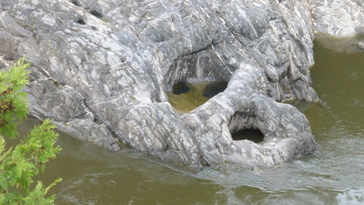
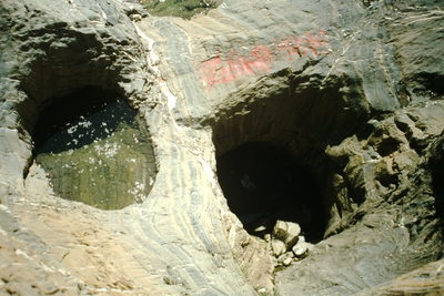
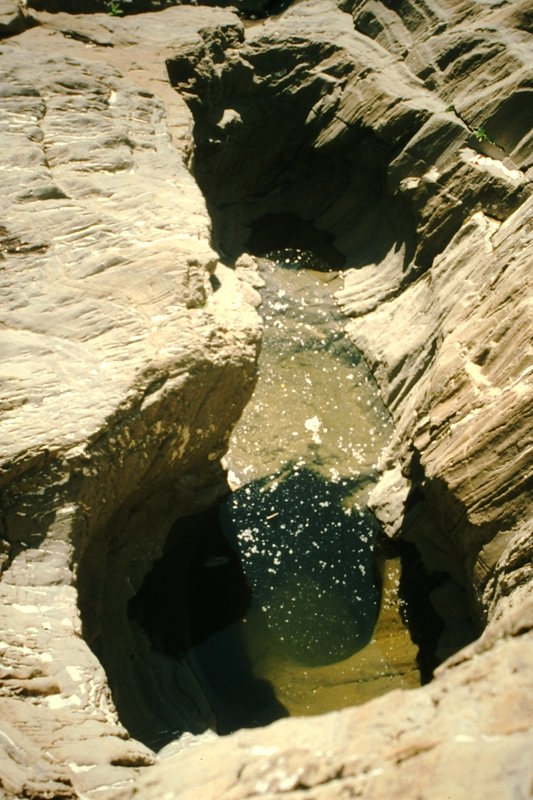
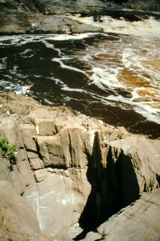
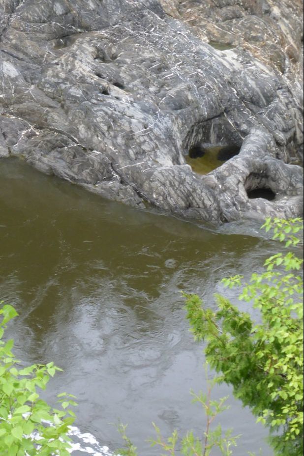
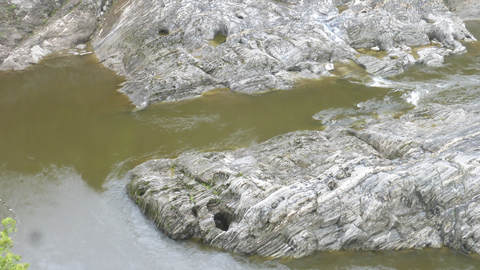
In the gorge of an upland river, the bedrock stream banks are not much wider than the river rapids themselves. On those narrow banks, several large, vertical, cylindrical pits are sculpted into the dry rock surface. The flat bottoms of many of these potholes are made up of rounded pebbles and cobbles. The smooth rock banks are steep at the water’s edge, sloping into the turbulent stream whose complex motions hint at even more potholes still submerged.
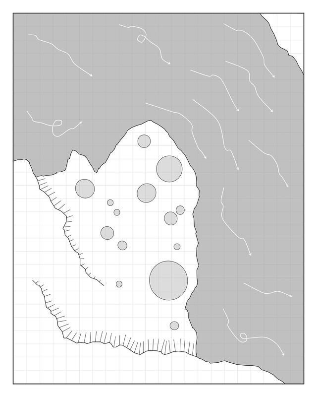
Dimensions These potholes are 2-15 feet (0.6-4 m) across. They are anywhere from a few inches (10 cm) to 10 feet (3 m) deep, with considerable difference in depth even among closely adjacent potholes. The river is 50-100 feet (15-30 m) across, hemmed in by steep rock walls up to 200 feet (60 m) high. The sketch map shows white arrows for river flow, comb lines for steep drops on the bedrock surface (bristles point downward), and gray circles for potholes, on a five-foot (1.5 m) square grid. A larger-area image for this schematic map is available for download on the FOR GAME MASTERS page.
Key Details
- The walls of many potholes have a simple cylindrical form. Rare ones show glimpses of hidden recesses below narrow ‘bottlenecks’.
- Potholes are always vertical pits, even when cut into steeply slanting rock surfaces.
- Some potholes on the banks are dry inside (possibly drained by fractures in the rock), while others contain clear, stagnant water. The river water is quite cold, but during the day the sun is able to warm the water in potholes. This temperature contrast might even lead to a layer of mist on water-filled potholes as air cools in the evening.
- The finely textured rock surface provides good footing, so long as it stays dry.
- Stranded logs 30 feet (10 m) above normal river level show the upper reaches of spring flood waters in the gorge.
- Origin of the potholes: When rushing flood waters cover these rocks, intense eddies swirl pebbles and small boulders in tight circles, grinding out circular pits in the rock surface. Once a pothole is begun, it becomes the location of eddies in future floods, so that it deepens and expands
Story Elements
- Steep rock edges at riverside, pothole edges, and low cliff lines on the bedrock surface make this area rough terrain, and a difficult place to move about in the dark.
- Someone deeply chilled, in danger of hypothermia, might crawl from river and find saving warmth in a sun-heated pothole.
- Gold pieces or heavy metal artifacts, washed down by floods, may collect in potholes. Locals might make a practice of scavenging here (and might be very touchy about strangers approaching ‘their’ holes).
- Something special, in need of protection, might exist between floods in the still in waters of the potholes (for example, concentrated minerals from evaporation, or creature(s) choosing potholes for temporary homes).
- A pothole might be used in a ritual, possibly to brew something, or to contain a nighttime fire visible only from certain viewpoints above.
- An artificially made circular shaft opening on the bedrock surface might be concealed among the potholes.
- There are many opportunities for hiding and stealth here. A head might suddenly pop up from below ground level. The sound of rushing water in the gorge would mask footsteps and whispered conversation, even very close by.
- Battle dynamics:
- Any hand-to hand combat will involve tricky maneuvering around pits, and possibly falling into rushing water.
- The deeper potholes can hide foes, or might be camouflaged as pit traps.
- Even where combatants can stand in shallower, slower-moving patches of river water, they will be walking on a rough rock surface with hidden pits.
Reference Location
The gorge of the St. John River, Grand Falls, east-central New Brunswick, Canada. The giant potholes are named ‘Wells in Rock’, and can be accessed by 250 stairs (admission charge). A public trail follows the mile-long gorge below the falls.
© Rice-Snows 2017
Proudly powered by Weebly
