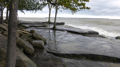
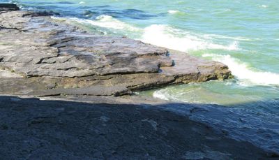
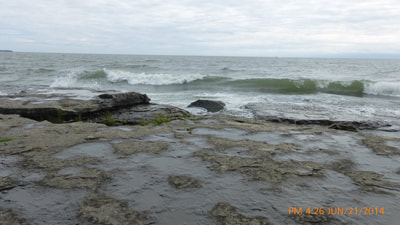
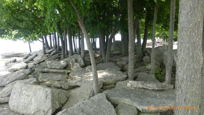
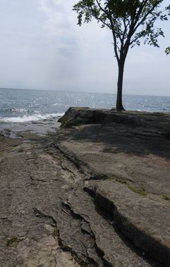
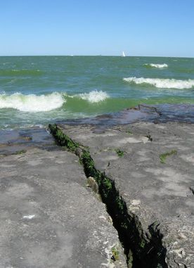
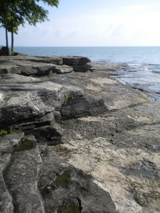
A low bedrock point guards the entrance to a bay on a vast freshwater lake. A forested island appears as a low, flat silhouette three miles (5 km) offshore. The ground on the point is made up of layered gray limestone bedrock, covered in places by broad loose slabs of the rock that have been broken off and piled up by strong winter waves. As a result, the surface is a series of low platforms and steps. Straight fractures split the rock in open clefts that are inches to a few feet (10's of cm) wide. A grove of small trees occupies part of the bare rock surface, with roots wedged into fractures.
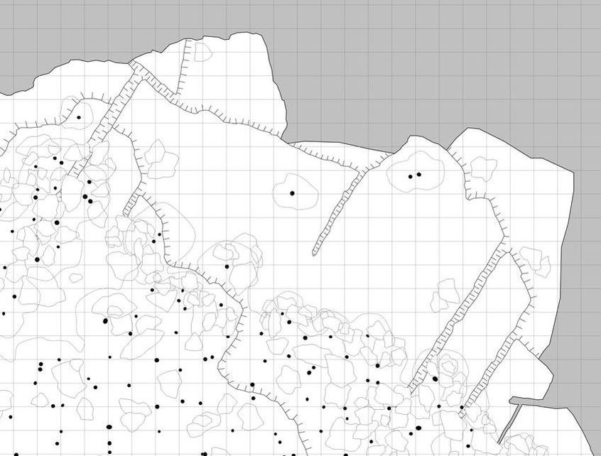
Dimensions The bare rock surface extends 20-40 feet (6-12 m) inland from the water’s edge, before meeting closely-spaced trees and piles of loose slabs. The upper platforms of the rock surface stand five feet (1.5 m) above lake level. Comb lines on the sketch map show significant (1-2 ft., 30-60 cm) steps down on the rock surface; the comb ‘tines’ point downward to lower platform levels, or into fracture clefts. Loose rock slabs are shown as rough polygons, tree trunks are marked by black circles, and light dashed lines show approximate limits of deciduous foliage cover. The map is on a five-foot (1.5 m) grid base. Most of this shoreline faces the open lake, while the shore near the map’s lower edge overlooks the bay entrance. A larger-area image for this schematic map is available for download on the FOR GAME MASTERS page.
Key Details
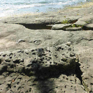
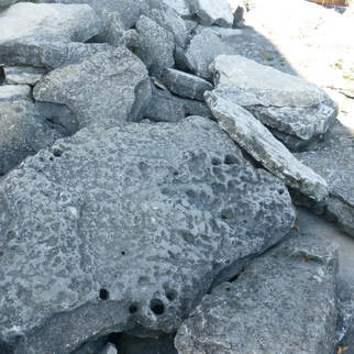
- Many parts of the bare rock are nearly smooth. However other areas of the limestone surface are pock-marked, including some pits deep enough to provide a finger-hold or catch a foot.
- Rock fragments can be found containing fossil corals and remains of other ancient sea life.
- Winter waves have pushed loose slabs up against the bases of the closely-spaced trees, creating difficult footing in the relatively sheltered area inshore of the bare rock surface. Some rock slabs aren’t firmly based, and will tilt under a careless step.
- When the waves are gentle and the sun is out, the lower rock platforms are dry right to the water’s edge. In rougher weather, waves splash broadly and unpredictably across the rock, making it slippery.
- In the early summer, the entire shoreline is plagued by mayflies, 1-2 inch long delicate insects. While harmless, they seem to occupy every solid surface, making it difficult to grab onto or brush against anything without a slippery smear of squashed bug resulting. The mayflies are also on the water, voraciously fed on by fish, which in turn provide a field day for water birds.
- In rare, cold winters, lake surface ice extends all the way to the island, thick enough to allow a cautious passage on foot or sled.
- The bay mouth is four miles (6 km) wide. The bay itself is several miles/kilometers wide and fifteen miles (27 km) long.
Story Elements
- This is a natural observation/control point for a major bay and harbor. It is a likely placement site for a lighthouse, watch tower, or gun battery. Various spots on this point provide long-distance view in a broad arc.
- Any boat of much size, trying to approach this point, will run aground on submerged bedrock slabs just offshore. This could be a place where wreckage piles up.
- This would be a good spot to begin or end a water experience – swimming to/from the island, or traveling further across the lake.
- This is a moody place, welcoming and nurturing on a sunny, quiet day; invigorating on a crisp, windy day; harsh and threatening in stormy weather.
- Especially in calm weather, this would be a great place for quiet reflection or conversation, perhaps leading to a epiphany or plan. This is also an excellent “happy place.”
- This is a good shore-fishing spot (especially when the mayflies are out); with choice of exposed or more sheltered waters within an easy stroll.
- A mayfly event could assume metaphorical or supernatural significance.
- A wide fracture cleft running inshore from the water’s edge, passing under loose slabs of rock, could provide a secret tunnel beneath the sheltered tree area, or below the base of some structure.
- The steps, fractures, jumbled slabs, and trees make this a possible place to hide or hunt for something even as large as a trunk or body.
- The sight of the island offshore explicitly presents the challenge to reach it.
- The community on the island (and other large islands nearby) may be on peaceful, equal terms with the population of the mainland. Alternatively, this relationship may be one of subjugation, or of commercial or military conflict, possibly driven by unequal access to and dependence on transported goods. In any such situation, this site will be a natural mainland outpost and transaction point.
- This location would be very vulnerable if hit by a giant wave or extreme storm.
- Battle Dynamics:
- This could be a key control/observation point to take or defend.
- A scene could be complicated by fluctuations of battle over strips of dry/wetted/jumbled rock, and areas of crashing waves and bursting spray.
- Attacker(s) could be perched in trees, or hidden in the dark, rough area below the tree canopy.
- The trees could be set on fire as a a signal or added defensive barrier.
- Deeper-draft boats approaching the shore would ground out on submerged bedrock slabs requiring attackers to wade ashore, possibly through buffeting breakers.
Reference Location
Marblehead Lighthouse State Park, Marblehead Peninsula, north-central Ohio. Other unique scenes within a few miles/kilometers of distance are Giant Grooves and Crystal Chamber.
© Rice-Snows 2017
Proudly powered by Weebly
